SatSummit
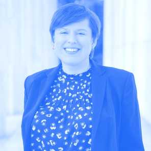
Picture of Susan Wolfinbarger, PhD
Washington DC '24
Speakers

Susan Wolfinbarger, PhD

She/Her.

Team Lead at Department of State.

About

Dr. Susan Wolfinbarger is the LOCATE Team Lead in the Bureau of Conflict and Stabilization Operations' Office of Advanced Analytics, where she leads CSO’s geospatial analysis and programmatic efforts. Susan is the former director of the Geospatial Technologies and Human Rights Project at the American Association for the Advancement of Science (AAAS), where she pioneered the use of remote sensing to document human rights violations around the world and, as part of that role, submitted expert evidence for international legal proceedings. Susan holds a Ph.D. in geography from The Ohio State University and a M.A. in geography from the George Washington University.

On the agenda

  1. Need for Speed

    May. 17 '24, 11:30am
    Session
    The Forum (South)

    This is a session on accelerating the cadence of imagery workflows for crisis response. The world is entering an uncertain period of conflicts and climate crises. How are US federal agencies adapting to the faster tempo around remote sensing workflows? What are decision-makers getting in their briefs, and what do they find useful? Where are the emerging gaps?

    Moderators

    1. John Crowley

    Speakers

    1. Katie Zezima
    2. Shanna N. McClain, PhD
    3. Susan Wolfinbarger, PhD

View all speakers

Sponsors

Platinum

  1. NASA Lifelines

Bronze

  1. Element84

  2. Esri

  3. Impact Observatory

  4. United States Agency for International Development (USAID)


Get the newsletter

* Required fields.

By clicking subscribe, you consent to allow SatSummit to store and process the personal information submitted to provide you the content requested.


Browse

SatSummit

An event by Development Seed and DevGlobal.

© 2015-2024